|
|||||||||||||||||||
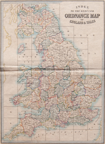
Cruchley's Complete Railway and Station Map of England and Wales with Part of Scotland Published by G. F. Cruchley, Map-Seller & Globe Maker
|
|||||||||||||||||||
G.F. CRUCHLEY – CARTOGRAPHER OF THE EARLY RAILWAY AGEGeorge Frederick Cruchley was a cartographer of the middle of the 19th century.
|
INDEX TO THE MAPS. CLICK ON THE ABOVE IMAGE FOR AN ENLARGED VIEW. THE GRID NUMBERS CORRESPOND TO THE PLATE NUMBERS OF THE MAPS OFFERED FOR SALE BELOW.
| Please click on above image for an enlarged view. The digital Darvill's watermark does not appear on the antique map. |
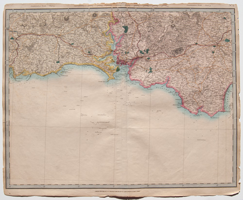
PLATE 2(The index map at the top of this page will help with locations) |
[Southeast Cornwall / South Devonshire] |
Cruchley's Complete Railway & Station Map of England and Wales with Part of Scotland Published by G. F. Cruchley, London |
Overall sheet size = approx. 26 x 21 inches (about 66 x 53 cm) Original 155+-year-old maps • hand-colored engraved maps, with center fold, as issued |
NOTE: ALL OF THE MAPS IN THIS SERIES HAVE NUMEROUS EDGE TEARS AND RAGGED TOP MARGINS. THERE IS ALSO AGE-APPROPRIATE TONING OF THE PAPER AND LIGHT FOXING. PLEASE ASSUME THIS TO BE TRUE OF EACH MAP OFFERED HERE. ANY OTHER MAJOR CONDITION ISSUES WILL BE NOTED BELOW.
|
| Please click on above image for an enlarged view. The digital Darvill's watermark does not appear on the antique map. |
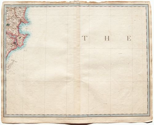
PLATE 3(The index map at the top of this page will help with locations) |
[South Devonshire / English Channel] |
Cruchley's Complete Railway & Station Map of England and Wales with Part of Scotland Published by G. F. Cruchley, London |
Overall sheet size = approx. 26 x 21 inches (about 66 x 53 cm) Original 155+-year-old maps • hand-colored engraved maps, with center fold, as issued |
NOTE: ALL OF THE MAPS IN THIS SERIES HAVE NUMEROUS EDGE TEARS AND RAGGED TOP MARGINS. THERE IS ALSO AGE-APPROPRIATE TONING OF THE PAPER AND LIGHT FOXING. PLEASE ASSUME THIS TO BE TRUE OF EACH MAP OFFERED HERE. ANY OTHER MAJOR CONDITION ISSUES WILL BE NOTED BELOW.
|
| Please click on above image for an enlarged view. The digital Darvill's watermark does not appear on the antique map. |
PLATE 4(The index map at the top of this page will help with locations) |
[part of the English Channel, south tip of Dorsetshire – Portland Race] |
Cruchley's Complete Railway & Station Map of England and Wales with Part of Scotland Published by G. F. Cruchley, London |
Overall sheet size = approx. 26 x 21 inches (about 66 x 53 cm) Original 155+-year-old maps • hand-colored engraved maps, with center fold, as issued |
NOTE: ALL OF THE MAPS IN THIS SERIES HAVE NUMEROUS EDGE TEARS AND RAGGED TOP MARGINS. THERE IS ALSO AGE-APPROPRIATE TONING OF THE PAPER AND LIGHT FOXING. PLEASE ASSUME THIS TO BE TRUE OF EACH MAP OFFERED HERE. ANY OTHER MAJOR CONDITION ISSUES WILL BE NOTED BELOW.
|
| Please click on above image for an enlarged view. The digital Darvill's watermark does not appear on the antique map. |
PLATE 5(The index map at the top of this page will help with locations) |
[part of the English Channel] |
Cruchley's Complete Railway & Station Map of England and Wales with Part of Scotland Published by G. F. Cruchley, London |
Overall sheet size = approx. 26 x 21 inches (about 66 x 53 cm) Original 155+-year-old maps • hand-colored engraved maps, with center fold, as issued |
NOTE: ALL OF THE MAPS IN THIS SERIES HAVE NUMEROUS EDGE TEARS AND RAGGED TOP MARGINS. THERE IS ALSO AGE-APPROPRIATE TONING OF THE PAPER AND LIGHT FOXING. PLEASE ASSUME THIS TO BE TRUE OF EACH MAP OFFERED HERE. ANY OTHER MAJOR CONDITION ISSUES WILL BE NOTED BELOW.
|
| Please click on above image for an enlarged view. The digital Darvill's watermark does not appear on the antique map. |
PLATE 6(The index map at the top of this page will help with locations) |
[part of the English Channel] |
Cruchley's Complete Railway & Station Map of England and Wales with Part of Scotland Published by G. F. Cruchley, London |
Overall sheet size = approx. 26 x 21 inches (about 66 x 53 cm) Original 155+-year-old maps • hand-colored engraved maps, with center fold, as issued |
NOTE: ALL OF THE MAPS IN THIS SERIES HAVE NUMEROUS EDGE TEARS AND RAGGED TOP MARGINS. THERE IS ALSO AGE-APPROPRIATE TONING OF THE PAPER AND LIGHT FOXING. PLEASE ASSUME THIS TO BE TRUE OF EACH MAP OFFERED HERE. ANY OTHER MAJOR CONDITION ISSUES WILL BE NOTED BELOW.
|
| Please click on above image for an enlarged view. The digital Darvill's watermark does not appear on the antique map. |
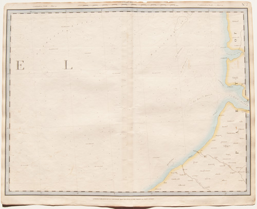
PLATE 7(The index map at the top of this page will help with locations) |
[part of the English Channel, northwest coast of France] |
Cruchley's Complete Railway & Station Map of England and Wales with Part of Scotland Published by G. F. Cruchley, London |
Overall sheet size = approx. 26 x 21 inches (about 66 x 53 cm) Original 155+-year-old maps • hand-colored engraved maps, with center fold, as issued |
NOTE: ALL OF THE MAPS IN THIS SERIES HAVE NUMEROUS EDGE TEARS AND RAGGED TOP MARGINS. THERE IS ALSO AGE-APPROPRIATE TONING OF THE PAPER AND LIGHT FOXING. PLEASE ASSUME THIS TO BE TRUE OF EACH MAP OFFERED HERE. ANY OTHER MAJOR CONDITION ISSUES WILL BE NOTED BELOW.
|
| Please click on above image for an enlarged view. The digital Darvill's watermark does not appear on the antique map. |
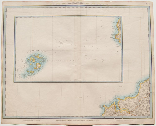
PLATE 8(The index map at the top of this page will help with locations) |
[west coast of Cornwall, inset of the Scilly Isles] |
Cruchley's Complete Railway & Station Map of England and Wales with Part of Scotland Published by G. F. Cruchley, London |
Overall sheet size = approx. 26 x 21 inches (about 66 x 53 cm) Original 155+-year-old maps • hand-colored engraved maps, with center fold, as issued |
NOTE: ALL OF THE MAPS IN THIS SERIES HAVE NUMEROUS EDGE TEARS AND RAGGED TOP MARGINS. THERE IS ALSO AGE-APPROPRIATE TONING OF THE PAPER AND LIGHT FOXING. PLEASE ASSUME THIS TO BE TRUE OF EACH MAP OFFERED HERE. ANY OTHER MAJOR CONDITION ISSUES WILL BE NOTED BELOW.
|
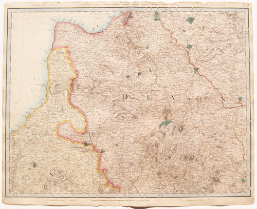
| Please click on above image for an enlarged view. The digital Darvill's watermark does not appear on the antique map. |
PLATE 9(The index map at the top of this page will help with locations) |
[northwest coast of Cornwall, north Devonshire] |
Cruchley's Complete Railway & Station Map of England and Wales with Part of Scotland Published by G. F. Cruchley, London |
Overall sheet size = approx. 26 x 21 inches (about 66 x 53 cm) Original 155+-year-old maps • hand-colored engraved maps, with center fold, as issued |
NOTE: ALL OF THE MAPS IN THIS SERIES HAVE NUMEROUS EDGE TEARS AND RAGGED TOP MARGINS. THERE IS ALSO AGE-APPROPRIATE TONING OF THE PAPER AND LIGHT FOXING. PLEASE ASSUME THIS TO BE TRUE OF EACH MAP OFFERED HERE. ANY OTHER MAJOR CONDITION ISSUES WILL BE NOTED BELOW.
|
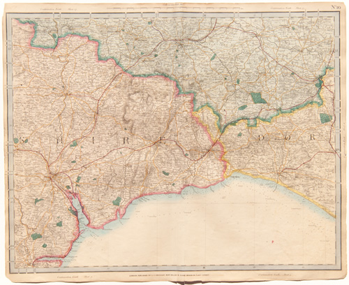
| Please click on above image for an enlarged view. The digital Darvill's watermark does not appear on the antique map. |
PLATE 10(The index map at the top of this page will help with locations) |
[parts of Devonshire, Dorsetshire and Somersetshire] |
Cruchley's Complete Railway & Station Map of England and Wales with Part of Scotland Published by G. F. Cruchley, London |
Overall sheet size = approx. 26 x 21 inches (about 66 x 53 cm) Original 155+-year-old maps • hand-colored engraved maps, with center fold, as issued |
NOTE: ALL OF THE MAPS IN THIS SERIES HAVE NUMEROUS EDGE TEARS AND RAGGED TOP MARGINS. THERE IS ALSO AGE-APPROPRIATE TONING OF THE PAPER AND LIGHT FOXING. PLEASE ASSUME THIS TO BE TRUE OF EACH MAP OFFERED HERE. ANY OTHER MAJOR CONDITION ISSUES WILL BE NOTED BELOW.
|
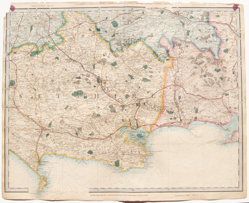
| Please click on above image for an enlarged view. The digital Darvill's watermark does not appear on the antique map. |
PLATE 11(The index map at the top of this page will help with locations) |
[parts of Dorsetshire, Somersetshire, Hampshire and Wiltshire] |
Cruchley's Complete Railway & Station Map of England and Wales with Part of Scotland Published by G. F. Cruchley, London |
Overall sheet size = approx. 26 x 21 inches (about 66 x 53 cm) Original 155+-year-old maps • hand-colored engraved maps, with center fold, as issued |
NOTE: ALL OF THE MAPS IN THIS SERIES HAVE NUMEROUS EDGE TEARS AND RAGGED TOP MARGINS. THERE IS ALSO AGE-APPROPRIATE TONING OF THE PAPER AND LIGHT FOXING. PLEASE ASSUME THIS TO BE TRUE OF EACH MAP OFFERED HERE. ANY OTHER MAJOR CONDITION ISSUES WILL BE NOTED BELOW.
|
| Please click on above image for an enlarged view. The digital Darvill's watermark does not appear on the antique map. |
PLATE 13(The index map at the top of this page will help with locations) |
[coast of Dorsetshire] |
Cruchley's Complete Railway & Station Map of England and Wales with Part of Scotland Published by G. F. Cruchley, London |
Overall sheet size = approx. 26 x 21 inches (about 66 x 53 cm) Original 155+-year-old maps • hand-colored engraved maps, with center fold, as issued |
NOTE: ALL OF THE MAPS IN THIS SERIES HAVE NUMEROUS EDGE TEARS AND RAGGED TOP MARGINS. THERE IS ALSO AGE-APPROPRIATE TONING OF THE PAPER AND LIGHT FOXING. PLEASE ASSUME THIS TO BE TRUE OF EACH MAP OFFERED HERE. ANY OTHER MAJOR CONDITION ISSUES WILL BE NOTED BELOW.
|
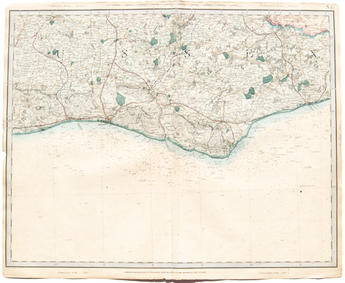
| Please click on above image for an enlarged view. The digital Darvill's watermark does not appear on the antique map. |
PLATE 14(The index map at the top of this page will help with locations) |
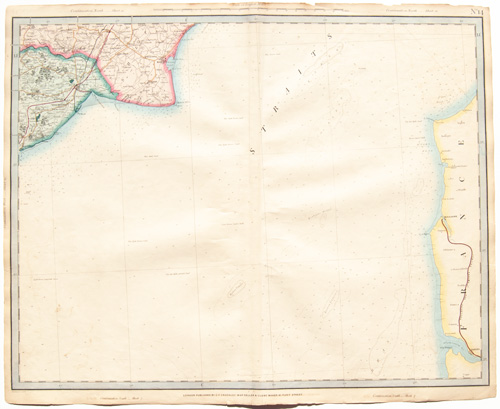
[part of Sussex, Kent, Straits of Dover, coast of France] |
Cruchley's Complete Railway & Station Map of England and Wales with Part of Scotland Published by G. F. Cruchley, London |
Overall sheet size = approx. 26 x 21 inches (about 66 x 53 cm) Original 155+-year-old maps • hand-colored engraved maps, with center fold, as issued |
NOTE: ALL OF THE MAPS IN THIS SERIES HAVE NUMEROUS EDGE TEARS AND RAGGED TOP MARGINS. THERE IS ALSO AGE-APPROPRIATE TONING OF THE PAPER AND LIGHT FOXING. PLEASE ASSUME THIS TO BE TRUE OF EACH MAP OFFERED HERE. ANY OTHER MAJOR CONDITION ISSUES WILL BE NOTED BELOW.
|
| Please click on above image for an enlarged view. The digital Darvill's watermark does not appear on the antique map. |
PLATE 16(The index map at the top of this page will help with locations) |
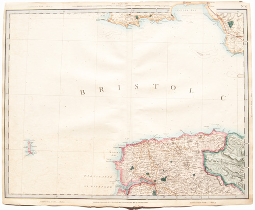
[part of north Devonshire, south Glamorganshire, Bristol Channel] |
Cruchley's Complete Railway & Station Map of England and Wales with Part of Scotland Published by G. F. Cruchley, London |
Overall sheet size = approx. 26 x 21 inches (about 66 x 53 cm) Original 155+-year-old maps • hand-colored engraved maps, with center fold, as issued |
NOTE: ALL OF THE MAPS IN THIS SERIES HAVE NUMEROUS EDGE TEARS AND RAGGED TOP MARGINS. THERE IS ALSO AGE-APPROPRIATE TONING OF THE PAPER AND LIGHT FOXING. PLEASE ASSUME THIS TO BE TRUE OF EACH MAP OFFERED HERE. ANY OTHER MAJOR CONDITION ISSUES WILL BE NOTED BELOW.
|
| Please click on above image for an enlarged view. The digital Darvill's watermark does not appear on the antique map. |
PLATE 19(The index map at the top of this page will help with locations) |
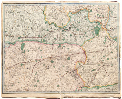
[part of Hampshire, Surrey, Berkshire] |
Cruchley's Complete Railway & Station Map of England and Wales with Part of Scotland Published by G. F. Cruchley, London |
Overall sheet size = approx. 26 x 21 inches (about 66 x 53 cm) Original 155+-year-old maps • hand-colored engraved maps, with center fold, as issued |
NOTE: ALL OF THE MAPS IN THIS SERIES HAVE NUMEROUS EDGE TEARS AND RAGGED TOP MARGINS. THERE IS ALSO AGE-APPROPRIATE TONING OF THE PAPER AND LIGHT FOXING. PLEASE ASSUME THIS TO BE TRUE OF EACH MAP OFFERED HERE. ANY OTHER MAJOR CONDITION ISSUES WILL BE NOTED BELOW.
|
| Please click on above image for an enlarged view. The digital Darvill's watermark does not appear on the antique map. |
PLATE 21(The index map at the top of this page will help with locations) |
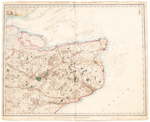
[part of Kent, Straits of Dover] |
Cruchley's Complete Railway & Station Map of England and Wales with Part of Scotland Published by G. F. Cruchley, London |
Overall sheet size = approx. 26 x 21 inches (about 66 x 53 cm) Original 155+-year-old maps • hand-colored engraved maps, with center fold, as issued |
NOTE: ALL OF THE MAPS IN THIS SERIES HAVE NUMEROUS EDGE TEARS AND RAGGED TOP MARGINS. THERE IS ALSO AGE-APPROPRIATE TONING OF THE PAPER AND LIGHT FOXING. PLEASE ASSUME THIS TO BE TRUE OF EACH MAP OFFERED HERE. ANY OTHER MAJOR CONDITION ISSUES WILL BE NOTED BELOW.
Stain in upper right corner |
| Please click on above image for an enlarged view. The digital Darvill's watermark does not appear on the antique map. |
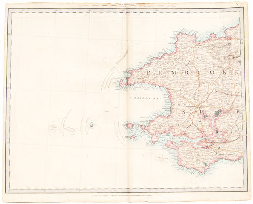
PLATE 22(The index map at the top of this page will help with locations) |
[West Pembrokeshire] |
Cruchley's Complete Railway & Station Map of England and Wales with Part of Scotland Published by G. F. Cruchley, London |
Overall sheet size = approx. 26 x 21 inches (about 66 x 53 cm) Original 155+-year-old maps • hand-colored engraved maps, with center fold, as issued |
NOTE: ALL OF THE MAPS IN THIS SERIES HAVE NUMEROUS EDGE TEARS AND RAGGED TOP MARGINS. THERE IS ALSO AGE-APPROPRIATE TONING OF THE PAPER AND LIGHT FOXING. PLEASE ASSUME THIS TO BE TRUE OF EACH MAP OFFERED HERE. ANY OTHER MAJOR CONDITION ISSUES WILL BE NOTED BELOW.
|
| Please click on above image for an enlarged view. The digital Darvill's watermark does not appear on the antique map. |
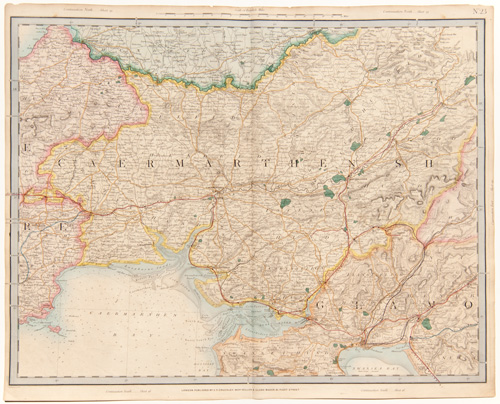
PLATE 23(The index map at the top of this page will help with locations) |
[part of Pembrokeshire, Caermarthenshire, Glamorganshire] |
Cruchley's Complete Railway & Station Map of England and Wales with Part of Scotland Published by G. F. Cruchley, London |
Overall sheet size = approx. 26 x 21 inches (about 66 x 53 cm) Original 155+-year-old maps • hand-colored engraved maps, with center fold, as issued |
NOTE: ALL OF THE MAPS IN THIS SERIES HAVE NUMEROUS EDGE TEARS AND RAGGED TOP MARGINS. THERE IS ALSO AGE-APPROPRIATE TONING OF THE PAPER AND LIGHT FOXING. PLEASE ASSUME THIS TO BE TRUE OF EACH MAP OFFERED HERE. ANY OTHER MAJOR CONDITION ISSUES WILL BE NOTED BELOW.
|
| Please click on above image for an enlarged view. The digital Darvill's watermark does not appear on the antique map. |
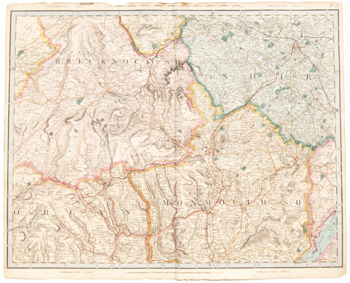
PLATE 24(The index map at the top of this page will help with locations) |
[part of Brecknockshire, Glamorganshire, Monmouthshire] |
Cruchley's Complete Railway & Station Map of England and Wales with Part of Scotland Published by G. F. Cruchley, London |
Overall sheet size = approx. 26 x 21 inches (about 66 x 53 cm) Original 155+-year-old maps • hand-colored engraved maps, with center fold, as issued |
NOTE: ALL OF THE MAPS IN THIS SERIES HAVE NUMEROUS EDGE TEARS AND RAGGED TOP MARGINS. THERE IS ALSO AGE-APPROPRIATE TONING OF THE PAPER AND LIGHT FOXING. PLEASE ASSUME THIS TO BE TRUE OF EACH MAP OFFERED HERE. ANY OTHER MAJOR CONDITION ISSUES WILL BE NOTED BELOW.
|
| Please click on above image for an enlarged view. The digital Darvill's watermark does not appear on the antique map. |
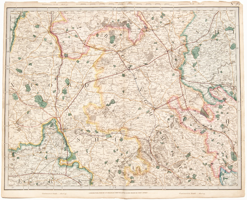
PLATE 26(The index map at the top of this page will help with locations) |
[part of Oxfordshire, Buckinghamshire] |
Cruchley's Complete Railway & Station Map of England and Wales with Part of Scotland Published by G. F. Cruchley, London |
Overall sheet size = approx. 26 x 21 inches (about 66 x 53 cm) Original 155+-year-old maps • hand-colored engraved maps, with center fold, as issued |
NOTE: ALL OF THE MAPS IN THIS SERIES HAVE NUMEROUS EDGE TEARS AND RAGGED TOP MARGINS. THERE IS ALSO AGE-APPROPRIATE TONING OF THE PAPER AND LIGHT FOXING. PLEASE ASSUME THIS TO BE TRUE OF EACH MAP OFFERED HERE. ANY OTHER MAJOR CONDITION ISSUES WILL BE NOTED BELOW.
|
| Please click on above image for an enlarged view. The digital Darvill's watermark does not appear on the antique map. |
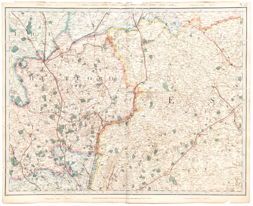
PLATE 27(The index map at the top of this page will help with locations) |
[part of Hertfordshire, Essex] |
Cruchley's Complete Railway & Station Map of England and Wales with Part of Scotland Published by G. F. Cruchley, London |
Overall sheet size = approx. 26 x 21 inches (about 66 x 53 cm) Original 155+-year-old maps • hand-colored engraved maps, with center fold, as issued |
NOTE: ALL OF THE MAPS IN THIS SERIES HAVE NUMEROUS EDGE TEARS AND RAGGED TOP MARGINS. THERE IS ALSO AGE-APPROPRIATE TONING OF THE PAPER AND LIGHT FOXING. PLEASE ASSUME THIS TO BE TRUE OF EACH MAP OFFERED HERE. ANY OTHER MAJOR CONDITION ISSUES WILL BE NOTED BELOW.
|
| Please click on above image for an enlarged view. The digital Darvill's watermark does not appear on the antique map. |
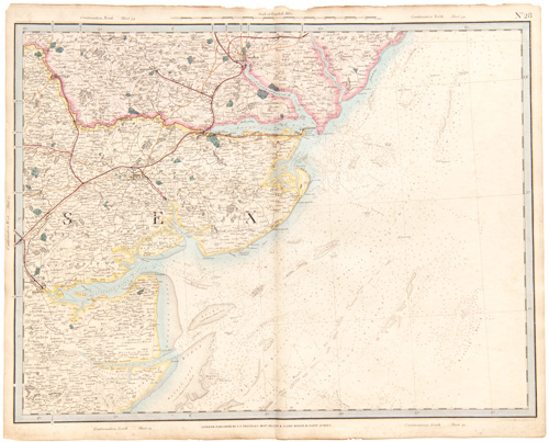
PLATE 28(The index map at the top of this page will help with locations) |
[part of Essex, Suffolk] |
Cruchley's Complete Railway & Station Map of England and Wales with Part of Scotland Published by G. F. Cruchley, London |
Overall sheet size = approx. 26 x 21 inches (about 66 x 53 cm) Original 155+-year-old maps • hand-colored engraved maps, with center fold, as issued |
NOTE: ALL OF THE MAPS IN THIS SERIES HAVE NUMEROUS EDGE TEARS AND RAGGED TOP MARGINS. THERE IS ALSO AGE-APPROPRIATE TONING OF THE PAPER AND LIGHT FOXING. PLEASE ASSUME THIS TO BE TRUE OF EACH MAP OFFERED HERE. ANY OTHER MAJOR CONDITION ISSUES WILL BE NOTED BELOW.
|
| Please click on above image for an enlarged view. The digital Darvill's watermark does not appear on the antique map. |
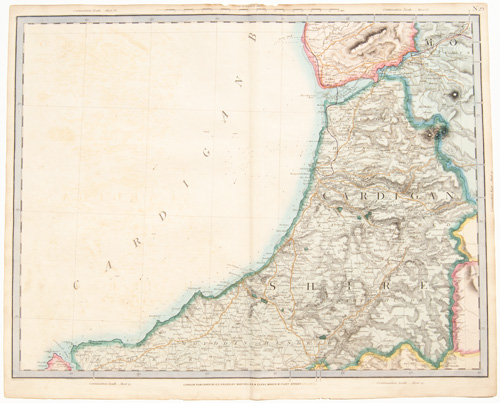
PLATE 29(The index map at the top of this page will help with locations) |
[part of Cardiganshire, Cardigan Bay] |
Cruchley's Complete Railway & Station Map of England and Wales with Part of Scotland Published by G. F. Cruchley, London |
Overall sheet size = approx. 26 x 21 inches (about 66 x 53 cm) Original 155+-year-old maps • hand-colored engraved maps, with center fold, as issued |
NOTE: ALL OF THE MAPS IN THIS SERIES HAVE NUMEROUS EDGE TEARS AND RAGGED TOP MARGINS. THERE IS ALSO AGE-APPROPRIATE TONING OF THE PAPER AND LIGHT FOXING. PLEASE ASSUME THIS TO BE TRUE OF EACH MAP OFFERED HERE. ANY OTHER MAJOR CONDITION ISSUES WILL BE NOTED BELOW.
SOME IMAGE TRANSFER LEFT SIDE |
(more maps from this series)
Thousands of original Vintage and Antique Maps and Sea Charts

